
Uncovering the Hidden Arctic
This video debuted at the 2020 Better Satellite World Awards Celebration.
Sponsored by
With additional support from

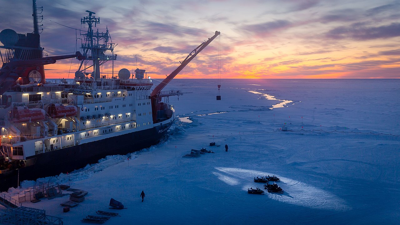
The Arctic. Bitterly cold, crossed by blinding storms and shrouded in darkness half the year, it is a place of legend where polar bears roam and gigantic icebergs plunge into the sea.
But the Arctic is changing. The six years ending in 2019 were the warmest ever recorded. As our climate changes, ice sheets on land shrink and ice covering the sea breaks up. Frozen lands change shape as permafrost in the soil melts. The Arctic is warming twice as fast as the rest of Earth and the changes are accelerating.
While the rest of the world fears rising sea levels, the warming Arctic is opening new shipping routes that promise to cut travel times. New fishing grounds will help feed the world, and new mineral deposits may supply the next generation of electric cars and wind turbines. Yet the hazards of the Arctic remain. The more people who journey there, the greater the risks to life, health and commerce.
Uncovering the Unknown via Satellite
For more than 20 years, KSAT has been providing detection of oil spills from space, turning satellite images into actionable data in 120 minutes or less. That fast detection means less impact on the environment and lower costs for clean-up.
Algae is a natural part of sea water. But when conditions are right, it can bloom into big, toxic masses. In 2019, an algae bloom off Norway struck fish farms, killing nearly 8 million salmon. KSAT is now supporting a satellite mission for a Norwegian university, testing the use of a technology called hyperspectral imaging to distinguish toxic blooms from harmless growth.
KSAT offers a ground monitoring service called inSAR in partnership with European companies. It tracks movements in the Earth’s surface down to the millimeter for scientists, governments, insurers and investors. As the world keeps warming, seeing how the land changes over time will become critical to helping us adapt.
Guiding Adventurers to Safety
And we need to adapt. In 2019, the extreme adventurer Mike Horn and polar explorer Borge Ousland began crossing the Arctic on foot. As they neared the end of their perilous journey, the ship that was supposed to pick them up got stuck in the shifting ice. Two other explorers set out on skies from the ship to reach them, bringing food and supplies. Temperatures were high, and deep crevices began to open in the ice, separating the two parties. But by analyzing high resolution satellite images, KSAT experts steered the adventurers to safety over a satellite phone. After 87 days on the ice, Horn and Ousland reached their ship, which finally broke free.
Our planet will keep changing in unexpected ways in the years ahead. Risk of extreme heat and cold, fierce storms and wildfires will increase. Rising to that challenge will take courage, ingenuity and foresight. We will also need insights on our planet that can only come from satellite technology and innovators like KSAT.
Today its mission is to be the world’s leading commercial satellite centre, giving access to satellites anytime, anywhere.
To be able to do so, KSAT has heavily invested in, and built a network of global ground stations, consisting of more than 200 remotely controlled antennas. With 23 sites worldwide, KSAT provides optimized locations for satellites in polar, inclined and equatorial orbits. In addition, the company offers Earth Observation services with the fastest available delivery times.
KSAT’s customers include both public and commercial users who have urgent, time-sensitive, operational requirements, as well as satellite owners and operators.
Share on Facebook | Share on Twitter | Share on LinkedIn
Photo by Stefan Hendricks, Alfred Wegener Institute. Used under Wikimedia Creative Commons Attribution-ShareAlike 4.0 International license.