
Putting a CAP on Climate Change
Sponsored by
With additional support from


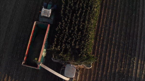
We need more sustainable ways to grow the food that gives us life. That’s what the European Union decided to do through changes to its common agricultural policy or CAP. The CAP distributes more than €50 billion each year to support farmers and keep food affordable. In 2019, the EU added a new goal: make European agriculture climate neutral by 2035. That would mean replacing traditional practices with sustainable ones across hundreds of millions of hectares of farmland. How is that even possible?
Each member state is responsible for its own farms, but the EU came up with a way to give them critical data on each one. Using public satellite data from Europe’s Sentinel-2 mission, countries capture visible changes in their farmers’ fields from planting to harvesting. Based on this data, they encourage farmers to adapt through sustainable practices with CAP funding as the incentive.
Supplementing Public Data with Help from Planet Labs
Adopting a new way of doing things is never easy, but in some parts of Europe there was a bigger issue. Take the country of Slovenia. It has many small farms with complicated layouts which the government found hard to analyze from the available data. Slovenia’s answer was service from Planet, a global Earth observation company.
Operating hundreds of satellites in low Earth orbit that capture images of Earth's entire land mass every day in Planet’s digital platform, the company combines its high-frequency private satellite data with the Sentinel public data. This data merger is powered by a service called Planet Fusion. It automatically harmonizes data from different sources to create a more complete record of changes over time and offers greater detail of European farms at a higher resolution and broader scale than ever before.
Satellite Data Informs Quick and Vital Decision Making
Slovenian government workers can now check the data from most phones and make a judgment in under 30 seconds. They need to visit fewer farms to double-check the analysis, and that has slashed more than €1 million from annual spending. When the EU committed to climate neutral farming, it was making a second promise as well to find a way to measure the actions of millions of farmers across the length and breadth of Europe. The fusion of satellite data lets governments verify what happens on the farm and offers farmers a reason to adopt new ways to sustainably grow the food that gives us life.
Planet’s Doves, which make up the world’s largest constellation of Earth-imaging satellites, “line scan” the planet to image the entire Earth daily. They launch new satellites into orbit every three or four months. Planet designs and builds its satellites in-house, allowing them to iterate often and pack the latest technology into their small satellites. Complete vertical integration enables Planet to respond quickly to customer needs and perpetually evolve their technology.
Planet’s Mission Control team uses patented automation software to manage their fleet of satellites, allowing just a handful of people to schedule imaging windows, push software in orbit, and download images to 45 ground stations throughout the world. Planet processes and delivers imagery quickly and efficiently. They use the Google Cloud Platform and enable custom processing so that customers can to tap directly into their data, the same way they do. Planet’s data pipeline ensures easy web and API access to Planet’s imagery and archive. They make every scene available as a tile service, composite scenes into mosaics, and build time-sliced mosaics so you can see change over time.