

In the good old days — before today’s bandwidth bonanza began pushing transponder capacity prices ever lower — the point of most satellite communications was the communications. It was about connecting a single broadcast center to millions of viewers, or headquarters to remote facilities, central offices to base stations or to objects in motion. That is still a major part of the business but, in a growing number of applications, the link is no longer the most valuable part of the solution — it is the data the link helps generate.
Entrepreneur and investor Marc Andreesen famously said that software is eating the world. Software and the data that powers it are actually reaching much further, out past the edge of Earth’s atmosphere to LEO, MEO and GEO. Satellite companies that operate in space and on the ground need to think much more broadly about the capabilities and services they provide, and value that may be hidden in the data they carry — especially if capacity costs continue to decline, as there is every reason to think they will.
Securing the Border
In June 2016, the United Nations reported that a record 65 million people around the world had been displaced by conflicts that flared from Latin America and the Middle East to Western Asia and the Pacific Rim. Nearly 41 million were still living within their own countries but 24 million — including 100,000 children — were desperately trying to reach safety and opportunity in a foreign land. Everywhere, more prosperous nations feel compelled to defend those boundaries from intrusion even as they struggle with the moral and practical challenges raised by an ever-rising tide of refugees, smugglers and potential attackers seeking entry.

Migrant workers at Egyptian-Libyan border. Photo: EU Civil Protection and Humanitarian Aid Operations
Border protection is a fine example of the trend for data — connected and collected by satellite — delivering value. Satellites play multiple roles; the first is visibility. Earth observation satellites provide detailed images of hot spots where border crossings peak. In the United States, the Department of Homeland Security shares data from military reconnaissance satellites with local, state and Federal agencies responsible for immigration and anti-smuggling programs. Sensors are able to penetrate cloud cover, detect chemical traces and even identify objects inside buildings. India uses the RISAT and Cartosat spacecraft to capture still images as well as high-resolution video of the nation’s disputed borders. South Africa has used satellite imagery to track activity at border control posts between that nation and Zimbabwe. The imagery picks up new roads and tracks, massed vehicles, temporary settlements and even places where fences have been compromised by migrants seeking access to one of Africa’s most stable and prosperous countries.
Satellites also provide data, video and voice communications with aircraft, helicopters, ground vehicles and maritime vessels on border patrol. That makes it possible for widely scattered forces to share data and images, and to operate as a single unit. Monitoring Australia’s coastline for illegal immigration and resource exploitation is only possible because satellite links a fleet of coast guard ships and small boats as well as camera-equipped surveillance aircraft. So successful have Unmanned Aerial Vehicles (UAVs) been on the southern border of the U.S. that drug smugglers have begun hacking into their communications to throw them off course. After gaining access to the drones’ control system, the smugglers feed the aircraft fake GPS coordinates that send them hurtling across the sky to the wrong location.
Right now, all of these services tend to be purchased separately from different vendors. Consider the opportunities for a service provider that focuses on creating a data platform that integrates and interprets information from all these sources in a way that is intuitive and customizable to the customer’s needs.
Promising Developments

Their first successful product was an accurate inventory of global oil storage, which national figures often fail to provide. With oil production and trading worth $1.7 trillion per year, an accurate and near-real-time inventory can signal the direction of future prices. To develop that inventory, Ursa acquired satellite imagery of oil tanks, focusing first on nations where published figures are particularly suspect. The roof of oil tanks rise and fall with volume to keep a steady pressure on their contents. Ursa used machine learning to develop software that could turn satellite images of tanks into reliable estimates of the amount of oil they stored. After countless hours of development and testing, its Global Oil Storage product became a winner. From there, the company developed a Chinese Refinery Demand report that provides a weekly tally of refinery runs, and a Well Monitoring product that can tell you how many wells were completed last week in America’s Permian Basin, without the weeks or months of delay such a report always required.
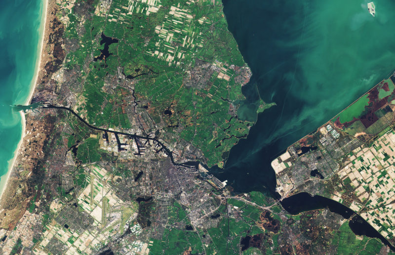
Amsterdam, Netherlands, see by the Copernicus Sentinel-2B satellite in March 2017. Photo: ESA
These products leverage major investments in space hardware and communications that somebody else paid for. Their value rests on cameras and connectivity, but much more on the ability to turn that data into intelligence that offers a unique solution to a customer problem. As Adam puts it, “we founded Ursa after witnessing the disconnect between information-rich satellite data and those who could really use it.”
Ursa is worth studying because it points the way to a successful future for the companies that take the pictures, scan the skies, connect the users and increasingly connect their devices one to another. The customer’s problem is never just the lack of a picture or connection. Solving the customer’s real problem is how the satellite business will sustain itself and grow in the future.
This article originally appeared in Via Satellite at https://www.satellitetoday.com/business/2018/05/01/is-the-data-worth-more-than-the-link/.