
Satellite Serves a Thirstier World
Sponsored By

Climate change has focused new attention on water. As the planet warms, faster evaporation and changing weather patterns are making the dry parts of the world even dryer. Political turmoil and human migration follow, with talk of “water wars” in the places where countries share a water supply. Ensuring that enough of the world’s people have access to enough water is now a challenge with global consequences. Fortunately, there is a global technology ready to help: satellite.
Finding the Water Supply
Scientists are even finding ways to use satellites to find water hiding underground, which makes up as much as 40 percent of global supplies. Using a NASA radar satellite, a team from Stanford University recently achieved the first success in predicting the amount of groundwater beneath locations in California. Another research team has proven that areas of lower temperature on the ground signal supplies of water below that are close to the surface. Knowing where the groundwater is near the surface can make a life or death difference in developing nations. Laborers with hand tools can dig shallow wells, while deeper ones require costly mechanized drills.
Protecting Purity
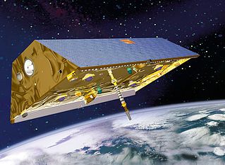
Having a source of water nearby does not guarantee an end to thirst. For much of our history, water has also been the place where our waste winds up, whether from sewer systems, factories or farmers’ fields. Images from satellites provide a cheap and powerful way to track pollution in real time. LANDSAT is the original network of earth observation satellites, launched by NASA beginning in 1972. Newer competitors include DigitalGlobe, Google’s Skybox and Planet. Through satellite images, it is possible to determine water quality by measuring its load of algae, which feeds on sewage and nitrates. A company called Blue Water Satellite has turned that technology into a business that identifies leaks, monitors potential pollution sources and assesses industrial impacts on water supplies.
Drought is part of the natural cycle in many places and the rise in global temperatures appears to be making the cycles worse. When the rain fails, the natural impulse is to pump more water from the ground to make up the difference. That’s especially true in agricultural regions, where 60-70% of groundwater goes to irrigation.
The trouble is, you can easily drain more water from the ground than nature restores. The result is the same as overdrawing your bank account.
Satellite data has revealed the impact of pulling too much water from the ground. California’s Department of Water Resources reported in 2015 that parts of the agricultural San Joaquin valley are sinking at the rate of 2 inches (5 cm) per month. The information came from a NASA radar satellite called InSer, which measures elevation with extreme precision. That sinking has already damaged thousands of wells. By compressing layers of soil and rock, it can permanently reduce the storage space available for groundwater.
The good news is that knowledge can lead to change. Parts of California’s Santa Clara Valley sank 13 feet in the first half of the 20th Century, but smart policies – diversifying water supplies and allowing the aquifer to recharge – stopped subsidence in its tracks.
Too Much of a Good Thing
As essential as it is, water can also be too much of a good thing. Flooding kills more people than any other natural disaster. Imagery from satellites is playing a key role in reducing the death toll and minimizing damage. In 2015, the African nation of Malawi began using data from the European Space Agency’s Sentinel 1 radar satellite to map massive floods on the Zambezi River. In addition to providing accurate maps to guide disaster response and recovery, the data is being used to develop a flood forecasting tool that will alert communities to danger before it strikes.
In 2000, the United Nations set development goals for the new millennium. One of them was to cut in half the number of people without access to clean water and sanitation. That goal was met. From 1990 to 2015, 2.6 billion gained access to clean water and 2.1 billion to sanitation. But the UN also expects that, by 2025, water scarcity will affect 1.8 billion people, and access to water will be an occasional issue for a remarkable two-thirds of us. With water becoming more precious by the year, satellite will help us find and protect it – and sometimes defend us from it – for decades to come.

Sources: “Satellite Missions Improve Water Estimates,” by Matteo Luccio, Sensors & Systems, June 17, 2013. “Satellite Data Provides Picture of Underground Water,” Stanford University, ScienceDaily, June 18, 2014. “Potential for Satellite Remote Sensing of Ground Water,” by Matthew W. Becker, Ground Water, March-April, 2006. “Locating Shallow Water Using Satellite Imagery,” by Paul Knerr, AfricanWaterProjects.org, March 15, 2015. “Groundwater Pumping Speeding Subsidence in Central California,” Reuters, August 19, 2015. “The Hidden Costs of Groundwater Overdraft,” by Tara Moran, Jenny Choy and Carolina Sanchez, Water in the West, Stanford University, September 9, 2015. “California is Sinking Faster Than Thought, Aquifers Could Permanently Shrink,” by Tia Ghose, Science, September 15, 2015. “Sentinel-1 Monitors Floods in Malaway,” European Space Agency, January 20, 2015.